4 November 2023
 I
realize it has been months since I last posted a blog, but there’s a good
reason. I had another hand surgery, on my
left thumb this time. Had the surgery in
mid June, along with all our normal medical checkups. Three months of physical therapy, which is
the normal time frame for
I
realize it has been months since I last posted a blog, but there’s a good
reason. I had another hand surgery, on my
left thumb this time. Had the surgery in
mid June, along with all our normal medical checkups. Three months of physical therapy, which is
the normal time frame for  this. And, as
with my right hand, there was some extra swelling since that’s how my body just
reacts. As well as extra arthritis in
the joints, though that’s something that happens to most people with this
surgery.
this. And, as
with my right hand, there was some extra swelling since that’s how my body just
reacts. As well as extra arthritis in
the joints, though that’s something that happens to most people with this
surgery.
That
meant three months of my left hand not being  as dexterous as usual. Not that my left has ever been as helpful as
my right, but that’s normal for a right-handed person.
as dexterous as usual. Not that my left has ever been as helpful as
my right, but that’s normal for a right-handed person.
However,
it did make typing problematic. And Siri
was her usual unhelpful self with translating dictation into Siri-ish. Or Siri-isms.
I 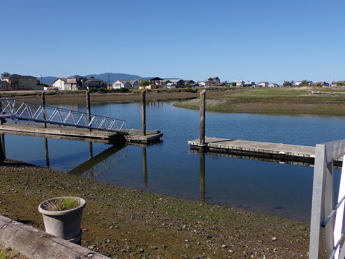 never know what to call her interpretations of English, but it makes
writing a blog exceedingly frustrating.
never know what to call her interpretations of English, but it makes
writing a blog exceedingly frustrating.
But
we somehow found probably the best ever place to spend a summer
recuperating. We rented an apartment in
a house on Sandy Point, a bit  north of Bellingham, Washington, but right on the
coast.
north of Bellingham, Washington, but right on the
coast.
We
had a ground floor two bedroom apartment with a small kitchen, a huge living room/dining
room area, a patio that ran across the width of the house, and my favorite
part, a gangway to a 50  foot dock!
SO gorgeous to sit on the patio and watch the sunsets. Or walk down to the dock and see the sea
birds, the crabs and sea plants in the shallows, or to talk to the seals that
came by and stopped to look at this strange creature.
foot dock!
SO gorgeous to sit on the patio and watch the sunsets. Or walk down to the dock and see the sea
birds, the crabs and sea plants in the shallows, or to talk to the seals that
came by and stopped to look at this strange creature.
I
think these were harbor  seals. We had
two seals who came in the boat canal for a week or two. I wasn’t sure if they were somehow lost and
stuck in this interior canal on the peninsula, or if this was normal. So after five days, I called Fish & Wildlife, and had an
extended call with a marine mammal expert.
Turns out that seals have
seals. We had
two seals who came in the boat canal for a week or two. I wasn’t sure if they were somehow lost and
stuck in this interior canal on the peninsula, or if this was normal. So after five days, I called Fish & Wildlife, and had an
extended call with a marine mammal expert.
Turns out that seals have  what experts call a “haul out period.” Seals need to get out of the water and lie in
the sun to warm up every few hours, so they haul themselves onto beaches,
docks, boats, even sea buoys. But during
the summer, as the seal pups reach adolescence, parent seals teach their young
to do this, as well as how to
what experts call a “haul out period.” Seals need to get out of the water and lie in
the sun to warm up every few hours, so they haul themselves onto beaches,
docks, boats, even sea buoys. But during
the summer, as the seal pups reach adolescence, parent seals teach their young
to do this, as well as how to  fish, open clams, find crabs, all the skills they
need to survive on their own. Seal
school.
fish, open clams, find crabs, all the skills they
need to survive on their own. Seal
school.
That’s what we saw, seal school – no idea if this was a mother or father seal
with the adolescent, but they spent about two weeks in one of the side areas on
the boat canal,  swimming past our dock every day. I’d go out and talk to them – the parent
would ignore me, but the young one would often stop and just watch me with
their giant eyes, trying to understand.
swimming past our dock every day. I’d go out and talk to them – the parent
would ignore me, but the young one would often stop and just watch me with
their giant eyes, trying to understand.
There
was even a very young one, all alone, who was still a mottled grey  color rather
than the dark color like the older seals.
He/she stopped and watched me for a while. It was a chilly evening as I chatted with
this little seal, then I said okay, gotta go, goodbye, and gave a little
wave. My seal buddy actually gave me a
little tiny fin wave, somewhere between a shoulder shrug and a full wave! Really, my funniest animal
color rather
than the dark color like the older seals.
He/she stopped and watched me for a while. It was a chilly evening as I chatted with
this little seal, then I said okay, gotta go, goodbye, and gave a little
wave. My seal buddy actually gave me a
little tiny fin wave, somewhere between a shoulder shrug and a full wave! Really, my funniest animal  encounter in a long
time!
encounter in a long
time!
We
also had two families of Canada geese, and watched the goslings grow up. There was a bald eagle who would fly by
several times a week. A family of purple
martins nested in a hole in one of the dock pilings – they  look rather like
swallows, but a bit more “robust,” as my birding friend called their body
shape. Several cormorants, sea birds that swim with their bodies underwater and only their necks sticking out, so they look like tiny Loch Ness monsters. And a belted kingfisher who
showed up for a few days.
look rather like
swallows, but a bit more “robust,” as my birding friend called their body
shape. Several cormorants, sea birds that swim with their bodies underwater and only their necks sticking out, so they look like tiny Loch Ness monsters. And a belted kingfisher who
showed up for a few days.
The
only land mammals 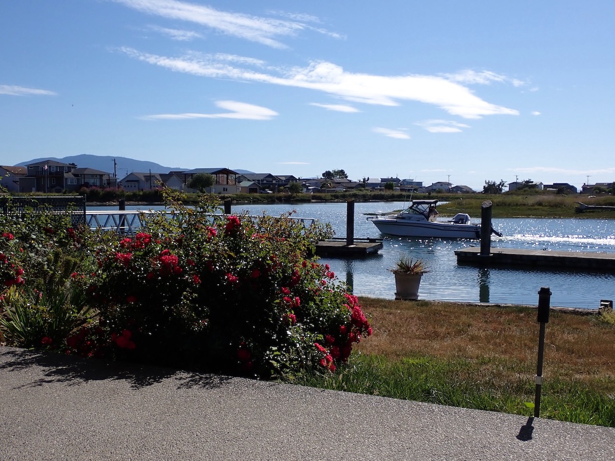 seemed to be rabbits who’d hop through the yard and nibble
grass. We also had several baby garden
snakes. Fortunately western Washington
has no venomous snakes, so I knew we could just ignore the snakes.
seemed to be rabbits who’d hop through the yard and nibble
grass. We also had several baby garden
snakes. Fortunately western Washington
has no venomous snakes, so I knew we could just ignore the snakes.
This area has about a  twelve-foot tidal change, so high tide had water just a few feet lower than our yard. Low tide was way out, beyond the supports under our gangway. There wasn't really a beach, just cobblestones and mud and muck.
People
who don’t know western Washington 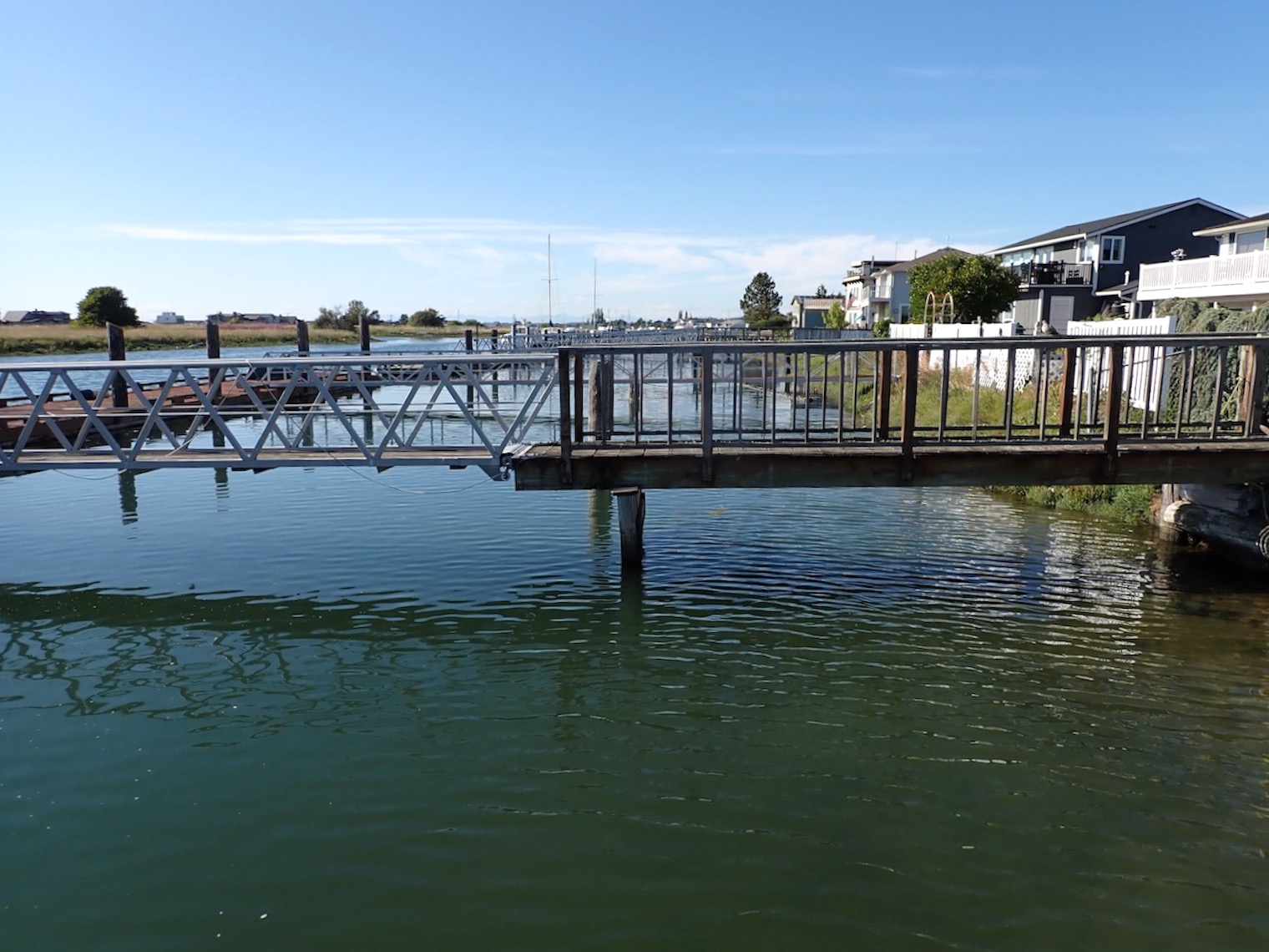 would ask, where were you located? It’s kind of hard to explain. The short answer is that we were on the Salish
Sea. Never heard of it, right? It's a new but better name for the
inland waters up here in the Pacific West.
would ask, where were you located? It’s kind of hard to explain. The short answer is that we were on the Salish
Sea. Never heard of it, right? It's a new but better name for the
inland waters up here in the Pacific West.
This
region has always been called Puget Sound  - but if you look at a map,
Bellingham is actually quite a bit north of Puget Sound. It's north of the area where the
Pacific Ocean cuts into North America (the Straits of Juan de Fuca) and reaches
around the Olympic Peninsula, and Puget Sound heads south from there.
Bellingham is much closer to the sea
- but if you look at a map,
Bellingham is actually quite a bit north of Puget Sound. It's north of the area where the
Pacific Ocean cuts into North America (the Straits of Juan de Fuca) and reaches
around the Olympic Peninsula, and Puget Sound heads south from there.
Bellingham is much closer to the sea  leading into the Canadian waters which are
called the Straits of Georgia. (This is the area between mainland British
Columbia and Vancouver Island.)
leading into the Canadian waters which are
called the Straits of Georgia. (This is the area between mainland British
Columbia and Vancouver Island.)
So,
in 2008, regional Native American nations as well as geographers proposed calling all these
combined waters the Salish Sea – the  regional indigenous peoples of various
tribes are called the Coastal Salish, and have similar languages. The Salish Sea seemed like a reasonable name for this region.
regional indigenous peoples of various
tribes are called the Coastal Salish, and have similar languages. The Salish Sea seemed like a reasonable name for this region.
That means we're on the Salish Sea, which makes more sense since we were never really on Puget Sound.
To top it off, our place is actually on a man-made canal that bisects the little peninsula called Sandy Point. It used to be a place used for gravel and sand pits. Being right on the sea, and made pf porous materials, digging was shallow because the sea water would fill deep holes. Eventually, someone bought the right to dig a canal connecting these gravel pits, creating a boat canal out to the sea. They also built a marina on the inland end of this canal.
A huge meadow was left undeveloped in the middle of the little peninsula, and that’s now a public park. We saw people walking or biking there; often, dogs would run down the edge of the meadow and jump in the water, swimming around while their owners either laughed or called them back to the trails.
This peninsula is jutting out into the sea, but adjacent to Lummi Nation land. (Actually, Sandy Point is part of the Lummi tribal land, but the homeowners do hold deeds to the land, so technically this is deeded tribal land or something. Not leased, at any rate.) On the Fourth of July, most residents bought fireworks from various businesses on tribal land, and we had quite a show in our neighborhood! It was exciting to stand on the dock and watch about four or five different places where people shot off fireworks fairly consistently, as well as the sporadic and random rockets being fired off by more timid or less affluent neighbors. Richard and I are very cautious about fireworks, so we didn’t buy or shoot off any – we just watched from the dock or the patio.
There’s also an odd mid-summer festival called Elvis at the Point. I had never heard of it, and have no idea how long this has been going on. But Elvis impersonators, both amateur and professional, come for this competition and sing their hearts out for one long evening. We sat on our porch and listened – some were better than others, all were entertaining. We sang along to each other, neither of us sounding anything remotely Elvis-like, but amusing ourselves.
I’ve added three maps to show where we spent our summer – you can see where we were located in relation to Canada, as well as the San Juan islands. Our view was the back side of Orcas Island, Lummi Island to the south, and the Canadian Cascade Mountains to the north. If we crossed the street, we saw Mount Baker to the east. Our place was at the red star.
This was the perfect spot to share with friends willing to make the two hour drive up from Seattle, or friends visiting from other states. I hosted four brunches this year – I could measure how my hand was doing based on how much assistance I needed from the friend who was sharing brunch. Really, I went from needing someone to cut up fruit and put the frittata pan into the oven, to doing everything myself!
Sandy Point is a bit of a vacation spot for locals, so many of the homes are second or vacation homes. The place is a bit emptier in winter, given that not everyone is a year-round resident. It probably is rather desolate in winter, between the grey rainy weather and early sunsets.
But it was a gorgeous place to spend a summer, with long evenings and brilliant sunsets. I really loved being there for four months, right on the water!
We left by late September, heading south for the winter. There will be a quick road trip summary blog, and then an intro to our winter location. So, check back!