26 October 2021


We continued on I-90 across the northern panhandle of Idaho, and didn't really stop until we were in Montana. The area around Lake Coeur d'Alene, Idaho, looks lovely, but it's always rather crowded with vacationers so we always drive on through. 
We stopped at a rest area that had really interesting 

The second sign gave all kinds of information about the geology of this area. About 15,000 years ago, during the most recent ice age, a huge glacier moved down from British 

Additionally, this ancient lake refilled and emptied seasonally for the next 2000 or so years, and evidence of the changing 
It really was interesting, and explained part of why eastern Washington is so flat and barren!
We spent a day in Missoula so I could drive 

I'm not exactly sure how to pronounce the names of the Native American nations that make up this confederation, but one sign included Séliš (the people we call Salish), Q´lispé, and Ksanka people as the stewards of 
Anyway, the National Bison Range was originally established to provide a refuge for the bison in western Montana, 
The bison here at the Bison Range are descended from a free-ranging Reservation herd started by tribal members in the 1800s, when plains bison were near extinction. A Pend 
There was the 
I paid my entrance fee at the visitor's center, received a lovely day pass to hang on the rearview mirror (though I just put it on the dashboard, I find things hanging from the mirror are very distracting), and asked about the two drives. The longer drive is 
Turned out the best chance of seeing bison is on the Grasslands Drive, so I headed off that way. Of course, I'm not good at following directions, and the woman who gave me directions had me quite confused, so I got totally lost and ended up at the picnic grounds below the entire range. I met a friendly family group who tried to help me, but they were equally confused by my map and my directions. So I went back to the visitor's center, and the woman gave me very exact directions, and I headed off on the Grasslands route.
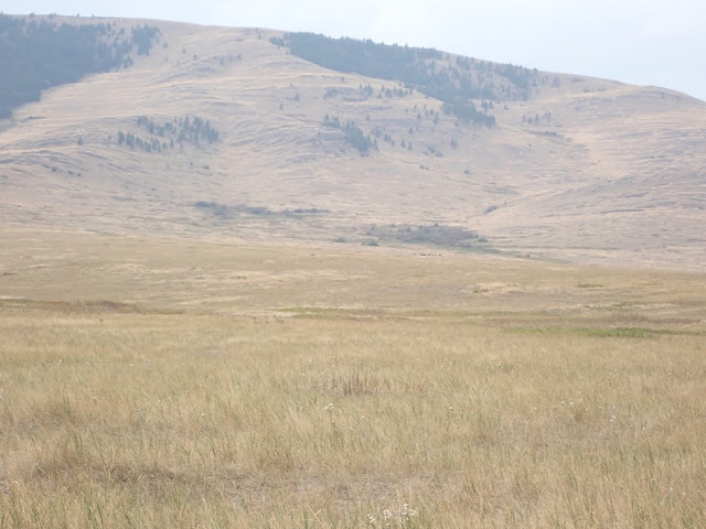
The scenery was beautiful - all fields and gentle slopes of golden wheat and amber grain. Tiny flowers in the grasses alongside the road. Dark green conifers on the taller hills beyond the grassy areas. Dotted random trees and bushes, some craggy rocky outcroppings. Stark but beautiful, with clouds scudding by overhead because it was a windy day.
Well, the bison were way up on the hills of the grasslands region. Too far for good photos, but they're the little dark dots up on the flattish areas of the long hills. They weren't close enough to the road for personal photos, but at least they were somewhat visible. It was a little disappointing, but, well, free range animals are just that, free to range wherever they want. As much as I like to see them close up, they have no obligation to do so. They also have little desire to meet me in person, no matter how much I'd like to think that they know I'm their friend, and they would be my friend if they met me. (Really, I do know how unrealistic that thought is.)
I did see quite a few pronghorn antelope, the females mostly nibbling grass or using the longer grass as camouflage. There were also small groups of female elk and deer trotting around. If you look closely at some of the photos, you can see a somewhat blurry deer or elk in there.
One male pronghorn did come by near enough for a few decent photos. He really was majestic, listening for any danger, trying to protect his herd of females, as they walked through the tall grasses.
Clouds kept blowing through, and the wind started picking up. When I finished the Grasslands Drive, I could see rain approaching from the west, so it seemed like a good time to drive back to Missoula.
It was absolutely worth this little side trip, even though I didn't get to see any of my bison friends close up and personal. Some enlarged photos, and there are larger versions of the maps showing our general route.


Loved the way you described how you wished to see the bison and are sure they would have sensed the friendship: but accept that free range animals are just that!! The wide expanses are lovely to see, such gentle colours.
ReplyDeleteLoved the pictures. Nice to be included in your trip.
ReplyDeleteAs always, thank you for the history lessons. Love the pictures!
ReplyDeleteEnjoyed sharing this leg of your road trip. Thank you for sharing.
ReplyDelete