25 April 2025
Where does the time go? I get involved in various projects, and suddenly four months have flown by!
Our winter was busy – Thanksgiving with our niece and her husband who live in Phoenix, plus our niece from Los Angeles came over. The Phoenix niece came down to Tucson for a weekend. I joined our local Urban Sketchers group, and went out with them several times. Richard and I also joined a gym somewhat near our house, and I’ve worked my way up to nine miles (in an hour) on the recumbent bike!
 Between
all of that, I managed to complete two more weaving projects, and each one
became easier. Plus much smoother, with
fewer mistakes. And finally, almost
straight sides! (My students would often
complain that their drawing was so much harder to do that when I drew the
example on the board. I would tell them
I had twenty (or fifty) years more
Between
all of that, I managed to complete two more weaving projects, and each one
became easier. Plus much smoother, with
fewer mistakes. And finally, almost
straight sides! (My students would often
complain that their drawing was so much harder to do that when I drew the
example on the board. I would tell them
I had twenty (or fifty) years more  practice than they had. Yes, so, weaving obviously takes a lot of
practice as well!!!)
practice than they had. Yes, so, weaving obviously takes a lot of
practice as well!!!)
I
didn’t bother taking photos of the process of weaving, just the two final woven
items. I figured anyone who follows our
 blog has probably read more about weaving techniques than they ever wanted to
know!
blog has probably read more about weaving techniques than they ever wanted to
know!
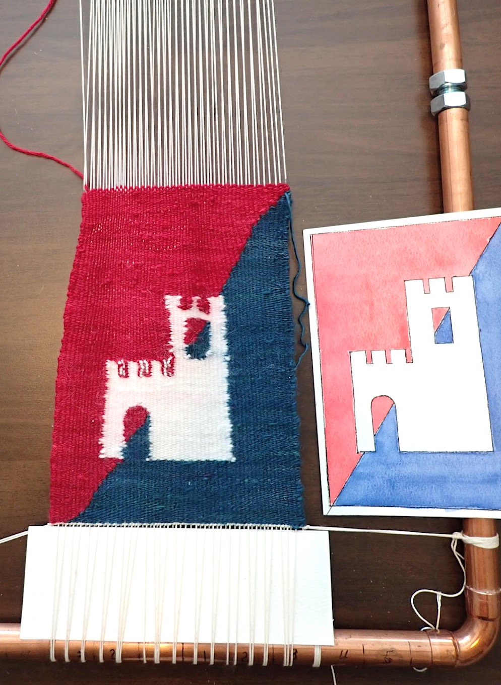
So,
weaving #3 – I used my original design, the castle from the San Gemini
neighborhood La Rocca. This time,
instead of putting my design on  the warp with the castle going vertically, or
standing up, I drew it horizontally, so the castle is lying on its side. This made it easier to have nice straight
lines for the sides of the castle as well as the crenellation on the towers.
the warp with the castle going vertically, or
standing up, I drew it horizontally, so the castle is lying on its side. This made it easier to have nice straight
lines for the sides of the castle as well as the crenellation on the towers.
However,
I had to make some changes. I originally
planned to have the diagonal line change between the red and blue background
sections, but I could quickly see I didn’t have enough indigo yarn to fill half
of the weaving.  So I switched it to a wide
stripe to the right side of the weaving, and the rest of the ground is the red
(cochineal dyed with tin mordant). It
just was easier than trying to find some comparable yarn, and then end up with
tons of yarn I’d need to use up.
So I switched it to a wide
stripe to the right side of the weaving, and the rest of the ground is the red
(cochineal dyed with tin mordant). It
just was easier than trying to find some comparable yarn, and then end up with
tons of yarn I’d need to use up.
You can see it’s a much cleaner weave, and even my color changes (bottom of the castle, tops of the crenellations) are much cleaner interchanges. It’s a fairly even sawtooth pattern, which is how it should look. Definite improvement in my weaving techniques! Especially when compared to the first castle weaving! (LIGHT YEARS better!!!)
Because my design was rotated 90º, the fringe is at the sides. Normally, if the design is woven as one would view it, the fringe would be at the top and bottom.
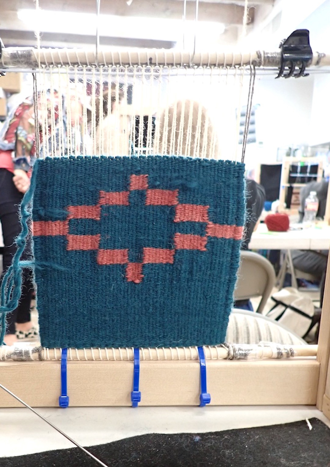
My fourth (and final) weaving was for a friend who had a rough year. An unexpected medical issue that became more involved to deal with, and seemed to continue on far longer than hoped. It seemed a weaving would definitely be a nice gift to cheer them up, right?
I found examples of how Navajo weavers portray birds, and copied the general style and shape. Changed the size to fit my loom, and used my computer to experiment with colors for the bird, the background, with or without stripes. Finally settled on a combination of colors, and managed to use up some of the yarn I accumulated with my two weaving workshops.
Set up my warp on the loom, and didn’t even have to re-do the bottom twisty line of twine! Started my weaving, and by the end of my first day of weaving, I had the green background plus red and midnight blue stripe woven, just to where the bird’s feet began! The bird took two days to weave, including the green around the bird. (My favorite part is the skinny blue curving lines in the white, for the wing – I wove about three rows of yarn for each curve, and it came out just the way I’d hoped!) Fourth day I finished the weaving, but I left it standing for several more days before I tied off the fringe. Apparently gravity helps compact the yarn, so sure, I’ll use that to help me with my art!
I used much of what I learned in the Navajo weaving workshop, especially shredding the ends of the yarn and overlapping so nothing hangs out the back. Also, my color changes use the Navajo style, so I have fewer mistakes. However, I used the French style of working parts of the weaving independently – so I wove the green up to the bird’s body, then wove part of the blue outline before going back and filling in that section with the white yarn. So, it’s kind of a mix.
But it’s pretty obvious that my skill level has improved tremendously! As well as my speed!
Richard and I made the decision to return to Tucson next fall and winter – I’m hoping the friendly nearby yarn and textile store hosts our two wonderful Navajo weaving ladies for another workshop in March! (They do have one scheduled for October, but the dates don’t work for me. We have a family even on the east coast, so we’ll be heading out during October.)
So, those are my adventures in weaving! At least for now. We’ll see what other fun things I can come up with in the future.